

0
Owner's of the Humminbird Marine GPS System Di Combo gave it a score of 0 out of 5. Here's how the scores stacked up:
26
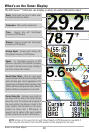
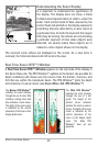
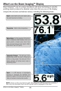
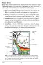
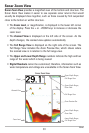
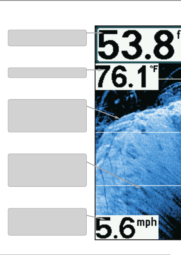
What’s on the Down Imaging™ Display
Down Imaging™ uses its unique transducer and sonar technology to provide
profiling beams produce the detailed sonar data that you see on the display.
interpret the structure and bottom contour, including the following items:
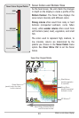
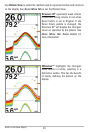
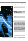
What’s onthe DownImaging™ Display
Depth-(waterdepth)canbesettoalarmwhen
the water becomes tooshallow.
Temperature -Water surface temperature.
Speed - If a GPS Receiver or Temp/Speed
accessory is connected, the Fishfinder can
display the speed of the boat and can keep a
Triplogof nauticalor statute miles traveled.
Topography Changes - The light part of the
display shows where the beam is hitting hard
bottom or rising terrain. The dark part of the
display indicates soft bottom (sand, mud) or
descendingterrain.
BottomReturn-Usetheappearanceofthebottom
return to determine bottom hardness. Rock and
gravel provide a clearer sonar return than
mud and sand because hard objects reflect
sonar better than soft objects.
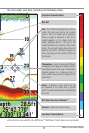
NOTE: Entries in this view that list (with Temp/Speed or GPS Receiver) are available if
then only the information from the GPS receiver will be displayed on the view.


Find Your Products By Category
- Communications
- Photography
- Portable Media
- Home Audio
- Kitchen Appliance
- Computer Equipment
- TV and Video
- Cell Phone
- Household Appliance
- Video Game
- Laundry Appliance
- Musical Instruments & Equipment
- Power Tools
- Automotive
- Car Audio and Video
- Outdoor Cooking
- Marine Equipment
- Lawn and Garden
- Personal Care
- Fitness & Sports
- Baby
Please Login
