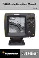

0
Owner's of the Humminbird Marine GPS System Marine GPS gave it a score of 0 out of 5. Here's how the scores stacked up:

23
Introduction to Navigation
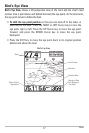
Use your 500 Series™ Fishfinder to mark waypoints at areas of interest and to
navigate to those waypoints via a savable route. A route represents the shortest
intended distance between waypoints. You can also view and save tracks,
which represent the actual path of the boat.
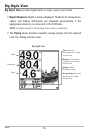
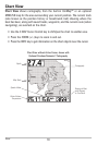
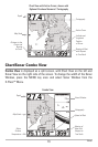
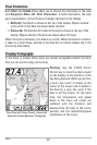
Waypoints, Routes, and Tracks
Waypoints are stored positions (latitude, longitude) that allow you to mark
areas of interest or navigation points (i.e. a marker buoy, dock, or fishing hole).
Your Fishfinder can store up to 3000 waypoints.
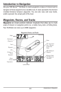
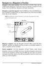
Waypoints, Routes, and Tracks
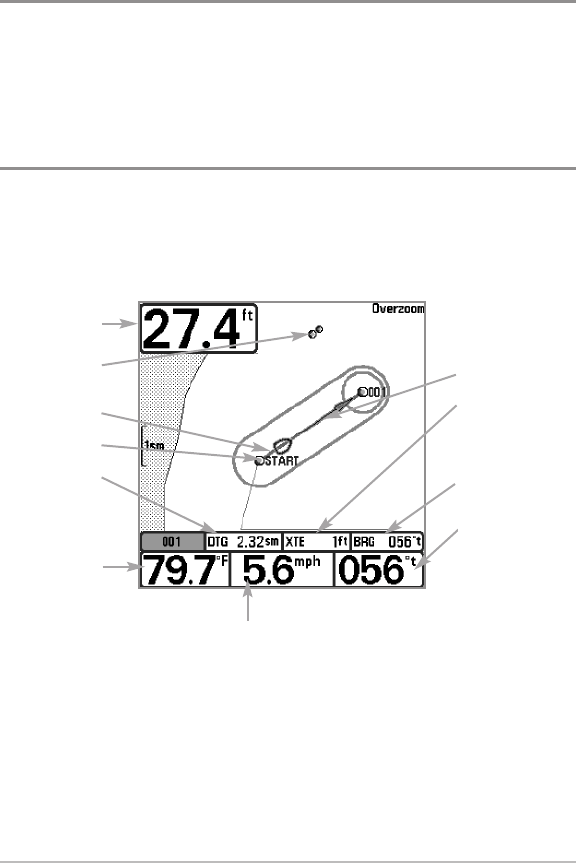
Route
XTE: Cross Track
Error. Distance
of Boat from
Route
BRG: Bearing to
Waypoint
Bearing of Boat
with Respect to
True North
Depth
Decluttered
Waypoints
Track
Waypoint
DTG:
Distance to
Go to
Waypoint
Water
Surface
Temperature
Speed of Boat
Introduction to Navigation


Find Your Products By Category
- Communications
- Photography
- Portable Media
- Home Audio
- Kitchen Appliance
- Computer Equipment
- TV and Video
- Cell Phone
- Household Appliance
- Video Game
- Laundry Appliance
- Musical Instruments & Equipment
- Power Tools
- Automotive
- Car Audio and Video
- Outdoor Cooking
- Marine Equipment
- Lawn and Garden
- Personal Care
- Fitness & Sports
- Baby
Please Login
