

0
Owner's of the Humminbird Marine GPS System Marine GPS gave it a score of 0 out of 5. Here's how the scores stacked up:

10
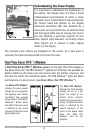
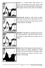
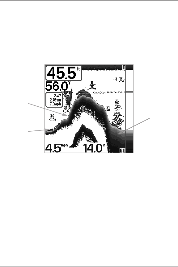
BBoottttoomm PPrreesseennttaattiioonn
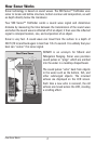
As the boat moves, the unit charts the changes in depth on the display to create
a profile of the Bottom Contour. The type of bottom can be determined from
the return charted on the display. A Hard Bottom such as compacted sediment
or flat rock appears as a thinner line across the display. A Soft Bottom such as
mud or sand appears as a thicker line across the display. Rocky Bottoms have
a broken, random appearance.
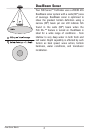
The sonar returns from the bottom, structure, and fish can be represented as
Inverse, Structure ID®, WhiteLine™, or Black (Bottom Black). See Sonar
X-Press™ Menu: Bottom View to set the bottom view.
Bottom Contour Profile with RTS Window™
Hard Bottom
Rocky Bottom
Soft Bottom
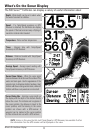
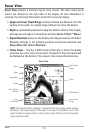
What’s On the Sonar Display


Find Your Products By Category
- Communications
- Photography
- Portable Media
- Home Audio
- Kitchen Appliance
- Computer Equipment
- TV and Video
- Cell Phone
- Household Appliance
- Video Game
- Laundry Appliance
- Musical Instruments & Equipment
- Power Tools
- Automotive
- Car Audio and Video
- Outdoor Cooking
- Marine Equipment
- Lawn and Garden
- Personal Care
- Fitness & Sports
- Baby
Please Login
