
0
Owner's of the Humminbird Marine GPS System GPS gave it a score of 0 out of 5. Here's how the scores stacked up:
45
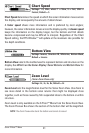
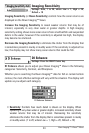
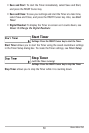
Down Imaging™ X-Press™ Menu
NOTE: The Sensitivity can be adjusted from the DI Enhance dialog box or the Down
Imaging™ X-Press™ Menu. The Sensitivity setting is provided here so that you can
easilyadjust theDown Imaging™ datawiththeothersettings. SeeDown Imaging™
X-Press™ Menu: Imaging Sensitivityformoreinformation.
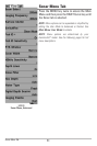
• Contrast: Accents the light and dark parts of the Down Imaging™ data
to provide greater definition. (1 to 20, Default = 10)
• Sharpness: Filters the view and sharpens the edges of the Down
Imaging™ data. (Low (L), Medium (M), High (H), Default = Off)
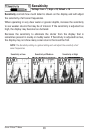
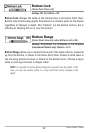
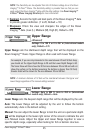
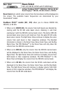
Upper Range
(Advanced)
Settings: 0 to 790 ft or 0 to 257 m (International models
only); Default = 0 ft
Upper Range sets the shallowest depth range that will be displayed on the
Down Imaging™ Views. Upper Range is often used with Lower Range.
NOTE: A minimum distance of 10 feet will be maintained between the Upper and
Lower Rangeregardless of the manual settings entered.
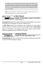
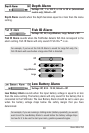
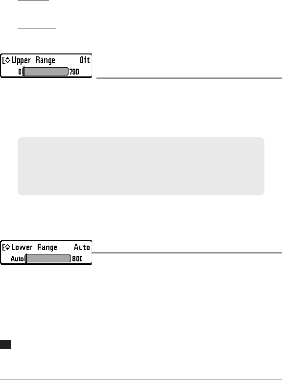
Lower Range
Settings: Auto to 800 ft, Auto to 260 m (International
models only); Default = Auto
Lower Range sets the deepest depth range that will be displayed by the unit.
Auto: The Lower Range will be adjusted by the unit to follow the bottom
automatically. Auto is the default setting.
Manual: You can adjust the Lower Range to lock the unit on a particular depth.
will be displayed in the lower right corner of the screen to indicate the unit
is in Manual mode. Adjust the Upper and Lower Range together to view a
specific depth range, especially when looking for fish or bottom structure.
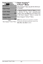
M
For example, ifyou areonly interested in the area between 20 and 50feetdeep,
you should set the Upper Depth Range to 20 and the Lower Depth Range to 50.
The Sonar View will then show the 30 foot area between 20 and 50 and will not
show the surface or the bottom (assuming the bottom is deeper than 50 feet).
Greater detail will beshown for the area between 20 and 50 feet.


Find Your Products By Category
- Communications
- Photography
- Portable Media
- Home Audio
- Kitchen Appliance
- Computer Equipment
- TV and Video
- Cell Phone
- Household Appliance
- Video Game
- Laundry Appliance
- Musical Instruments & Equipment
- Power Tools
- Automotive
- Car Audio and Video
- Outdoor Cooking
- Marine Equipment
- Lawn and Garden
- Personal Care
- Fitness & Sports
- Baby
Please Login
