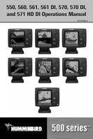

0
Owner's of the Humminbird Marine GPS System GPS gave it a score of 0 out of 5. Here's how the scores stacked up:
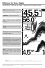
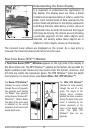

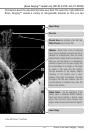
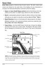
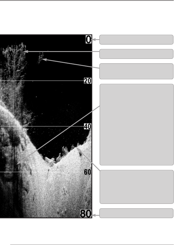
What’s on the Down Imaging™ Display
14
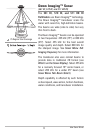
(Down Imaging™ models only [561 DI, 570 DI, and 571 HD DI])
informationabout the area directlybelow your boat. The razor-thin, high-definition
Down Imaging™ reveals a variety of recognizable features so that you can
tothe 500Series™Fishfinder.
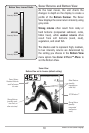
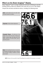
Clouded Area may indicate a bait ball and
White Streaks may indicate fish.
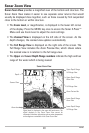
Upper Range
Structure
Lower Range
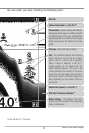
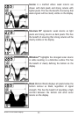
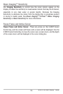
Bottom Return - Use the appearance of the
bottom return to determine bottom hardness.
Rock and gravel provide a clearer sonar
return than mud and sand because hard
objectsreflectsonar betterthansoft objects.
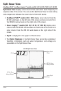
Shadows - Result from a lack of reflected
sonar from a particular area and can be as
valuable for interpretation than the sonar
reflectedbythe objectitself.Use shadowsto
help you see the image in 3 dimensions,
oriented in space. You can gain insight into
the actual shape of an object, or the depth
to which it has sunk into the bottom,
through shadows on the display. Objects
standing on the bottom cast a sonar
shadow. The longer the shadow, the taller
the object. Fish also cast shadows. You can
use the shadow to interpret how close the
fish is to the bottom.


Find Your Products By Category
- Communications
- Photography
- Portable Media
- Home Audio
- Kitchen Appliance
- Computer Equipment
- TV and Video
- Cell Phone
- Household Appliance
- Video Game
- Laundry Appliance
- Musical Instruments & Equipment
- Power Tools
- Automotive
- Car Audio and Video
- Outdoor Cooking
- Marine Equipment
- Lawn and Garden
- Personal Care
- Fitness & Sports
- Baby
Please Login
