
0
Owner's of the Clarion GPS Receiver NP401 gave it a score of 0 out of 5. Here's how the scores stacked up:
English
Owner’s
Manual
NP401 47
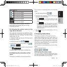
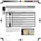
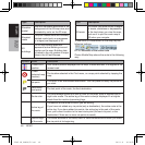
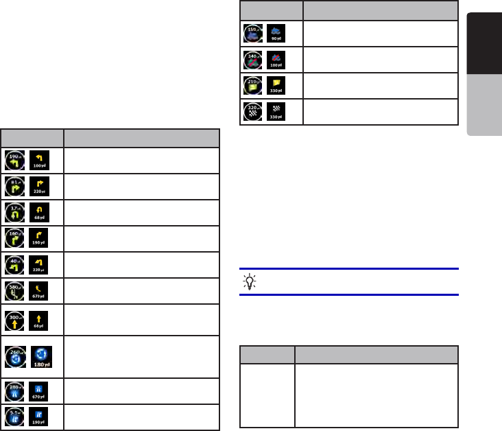
6.1.1.4Nexttworouteevents(TurnPreviewelds)
There are two fields reserved on the Map screen to
display the next two maneuvers (route events that
are listed in the Itinerary). Both the type of the event
(turn, traffic circle, exiting freeway, etc.) and its
distance from the current GPS position is displayed.
Most of these icons are very intuitive and you also
know them as road signs. The following table lists
some of the frequently shown route events. The
same symbols are used in both fields:
Icon Description
, Turn left.
, Turn right.
, Turn back.
, Bear right.
, Turn sharp left.
, Keepleft.
,
Continue straight in the
intersection.
,
Enter traffic circle. The number of
the exit is shown in the circle, but
only for the next turn.
, Enter freeway.
, Exit freeway.
Icon Description
, Board ferry.
, Leave ferry.
, Approaching the next via point.
, Approaching the destination.
In certain situations when route events are not
important, these fields show other useful pieces of
information. They are described here: page 38.
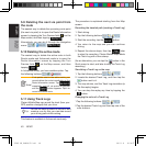
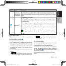
6.1.2Objectsonthemap
6.1.2.1Streetsandroads
Clarion Mobile Map shows the streets in a way
that is similar to how the paper road maps show
them. Their width and colors correspond to their
importance: you can easily tell a freeway from a
small street.
Tip!
If you prefer not to see street names
during navigation, turn them off (page 63).
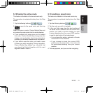
6.1.2.23Dobjecttypes
Clarion Mobile Map supports the following 3D
object types:
Type Description
3D
landmarks
Landmarks are 3D artistic or block
representations of prominent or well-
known objects. 3D landmarks are
only available in selected cities and
countries.
NP401 OM_100920_EN.indd 47 2011-1-6 16:10:58


Find Your Products By Category
- Communications
- Photography
- Portable Media
- Home Audio
- Kitchen Appliance
- Computer Equipment
- TV and Video
- Cell Phone
- Household Appliance
- Video Game
- Laundry Appliance
- Musical Instruments & Equipment
- Power Tools
- Automotive
- Car Audio and Video
- Outdoor Cooking
- Marine Equipment
- Lawn and Garden
- Personal Care
- Fitness & Sports
- Baby
Please Login
